Targomo’s location optimization platform, called TargomoLOOP, allows users to make in-depth analyses of locations and a complete network of branches. The platform is able to integrate all types of data, such as demographics, spending power, household sizes, age groups, movement data, sales figures and points of interest, and links them to their locations.
By analyzing data from a location perspective and using travel time analysis, TargomoLOOP can calculate the catchment areas of stores, offices and transportation networks. It visualizes the results on a map and in tables, making them easy to understand and communicate. TargomoLOOP also helps to identify the areas that offer the most potential for geo-marketing.
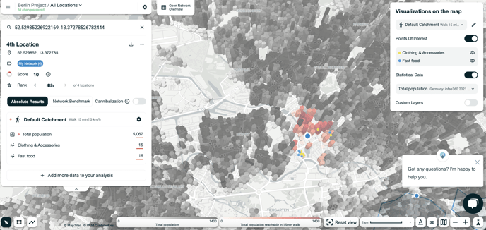
Summary:
- The left-hand menu displays data in graphics and tables.
- By clicking on a different variable in a graphic, for instance “Total population”, the catchment area displayed on the map changes.
- By changing the transportation mode and travel time, the data displayed in the graphics and in the list below the graphic changes. The catchment area on the map also changes.
- In the top, left corner you can click on the three stripes to get menu options and change settings.